Fort Frederica National Monument
Park History
Sourced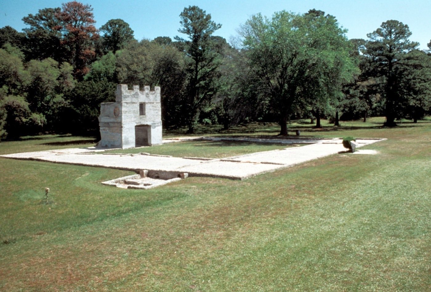
On St. Simons Island, Georgia, at a sharp bend in the Frederica River between salt marsh and live oaks hung with moss, lie the remains of Frederica, the fort and town James Oglethorpe laid out in 1736 to hold Britain’s southern frontier against Spanish Florida. The first settlers — 44 men, mostly skilled workers, and 72 women and children — built palmetto huts and then houses of wood, brick and tabby, a concrete of burnt oyster shell, along a 75-foot-wide Broad Street shaded by orange trees. At its height the town held about 500 people by the 2009 park brochure’s count, more than 800 by the 2016 foundation document’s. [1] [2]
Frederica was born of war. In early 1740 “the aggressive Oglethorpe,” as the 2009 brochure calls him, set out to capture St. Augustine with 900 troops and 1,100 Indian allies, and failed. In July 1742 a Spanish force landed on the island; British troops beat back one column within sight of the town and ambushed another at Bloody Marsh. Casualties were light, but within a week the Spanish withdrew, ending, in the Park Service’s judgment, Spain’s claim to Georgia and the Carolinas. Peace undid the town: the regiment was disbanded in 1749, and a visitor in 1755 found houses without inhabitants and streets overgrown with weeds. [1] [2]
Congress created the national monument on May 26, 1936. Its roughly 282 acres in two units protect a largely intact archeological record — the subject of more than 40 investigations since 1936, with more than 227,000 objects in the park’s collections — and tabby ruins such as the King’s Magazine that now stand in the path of an eroding riverbank. [2]
Indigenous peoples
Before Frederica there was a Guale village on the same ground, allied to Spain through trade and conversion to Catholicism; two Spanish missions stood on the island. The park’s history describes how English traders armed Native slave raiders — the Westo were the largest such group from 1679 into the early 1700s — and how British colonists and their allies attacked the coastal missions to enslave the Guale; in 1683 the village and missions were abandoned, their people following the Spanish south or forcibly removed. Half a century later the Yamacraw, a people of mixed Creek and Yamasee descent, served as treaty negotiators between Oglethorpe and the Creek, allowing Frederica’s peaceful founding in February 1736. Oglethorpe laid out the town lots on a field the Indians had planted in corn, and townspeople traded with Creek and Yuchi people outside the town gate. [3] [1]
Women
Coosaponakeesa, known as Mary Musgrove, was born at Coweta on the Ocmulgee River in 1700, the daughter of British trader Edmund Griffen and of a sister of the Lower Creek leader Brim. When Oglethorpe met the Yamacraw chief Tomochichi in 1733 she interpreted, and the colony paid her one hundred pounds sterling a year. She helped negotiate treaties, recruited warriors against Spain, supplied the struggling colonists with meat and bread, and in 1742 influenced the Creeks to aid the British on St. Simons. She owned three trading posts, and her third husband, Thomas Bosomworth, pressed claims to Sapelo, St. Catherine’s and Ossabaw islands granted to her by the Creeks — making her, in the park’s telling, the largest landowner in colonial Georgia. [4]
Black history
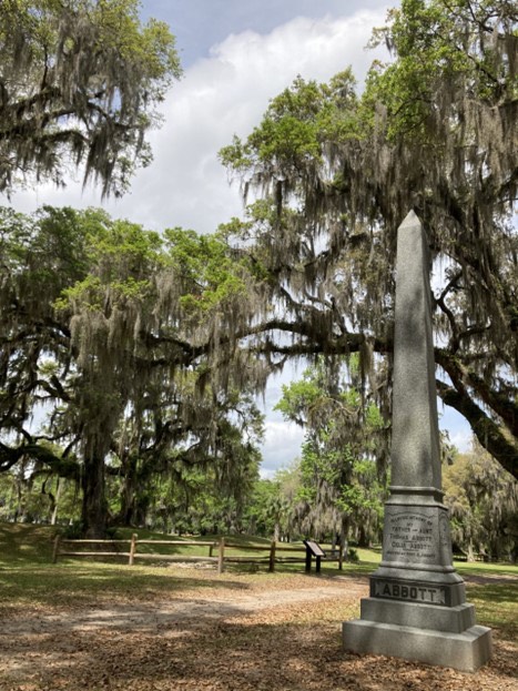
Just outside the town wall lies a small cemetery of freed people from the late 1860s and 1870s. One of them is Thomas Abbott, whom Charles Stevens — a coastal shipper who held nineteen people in slavery in 1860 and whose family owned much of the old townsite — had enslaved; another is Celia Abbott. Many freed people, the park notes, still worked for former enslavers after emancipation, often on the same land. Thomas Abbott’s son Robert, born on St. Simons, founded The Chicago Defender, a paper that aided African Americans during the Great Migration and exposed lynching; in 1928 he paid $1,500 for a monument to his ancestors. Ground-penetrating radar in 2017 and 2019 and a 2019 excavation, guided by a church map marking a “Colored burial lot,” confirmed the cemetery’s location. The monument, the 2016 foundation document says, links the park to the island’s African American community and the early struggle against racial prejudice. [5] [2]
Slavery
Frederica’s settlers farmed with their own hands, because Georgia banned slavery. The park attributes the ban both to the Trustees’ ideals and to fear: an enslaved person’s quickest way to freedom ran down the Frederica River to Spanish Florida, where accepting Catholicism and fighting for Spain could bring liberty. Colonists petitioned against the ban soon after Frederica’s founding; in 1751 Parliament allowed slavery. By 1775 nearly 18,000 people were enslaved in Georgia; St. Simons came to hold more than 14 plantations. In 1803 John Couper and Thomas Spalding bought 75 Igbo people in Savannah; on the voyage south, the park recounts, they overpowered their captors, took the ship into Dunbar Creek two miles from Frederica, and walked into the water rather than be re-enslaved. Long told as legend — the park notes details vary by source — the event is documented in letters to Pierce Butler, one recording bodies salvaged at ten dollars a head. [1] [6]
Climate & environment
The river beside which Oglethorpe placed Frederica is now eroding it. The 2016 foundation document warns that shoreline erosion along the Frederica River is an increasing threat, especially to the King’s Magazine, and that a rising water table and more frequent and intense storm surges tied to climate change could disturb buried archeological deposits. Salt marshes on the Georgia coast, it notes, may shrink by 20 to 40 percent this century as sea level rises. The document calls for working with Georgia’s Department of Natural Resources on a Living Shoreline project to stabilize the bank, and one of its interpretive themes concerns conserving and restoring the island ecology that shaped the lives of the people who lived there. [2]
Sources
- NPSHistory.com: Fort Frederica archive page — overview (from the 2009 NPS brochure) and establishment block
- Foundation Document, Fort Frederica National Monument, Georgia (NPS, 2016)
- NPS, Fort Frederica NM: The People Before Frederica (nps.gov, last updated September 12, 2024)
- NPS, Fort Frederica NM: Mary Musgrove (nps.gov, last updated October 20, 2022)
- NPS, Fort Frederica NM: Reconstruction Era History at Fort Frederica (nps.gov, last updated August 1, 2024)
- NPS, Fort Frederica NM: Igbo Landing (nps.gov, last updated September 9, 2024)
REVISE: Publications (1 items)
Fort Frederica National Monument in GA preserves a piece of American history that the public has trusted the National Park Service to protect and interpret. The visitor publications at this site have been developed over years by historians, subject-matter experts, and park staff — and are now being reviewed under Secretary's Order 3431.
Among the content targeted: “In early 1740 the aggressive Oglethorpe set out to capture St. Augustine.” — language that the administration has ordered revised under its directive to review historically accurate interpretive materials.
Why this matters: The specific language being targeted at Fort Frederica National Monument — including “In early 1740 the aggressive Oglethorpe set out to capture St. Augustine.” — is historically accurate content developed by professional historians and park staff. When this language is revised or removed, visitors lose access to the documented record of what happened here.
Request review of Park's Unigrid uses very descriptive verbiage. Possible concern of line in War and Decline section on right: “In early 1740 the aggressive Oglethorpe set out to capture St. Augustine.” Full unigrid shared for context.
REVISE: 2 exhibit photos, 3 document files
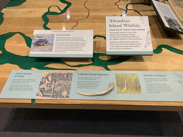
In 1736, James Oglethorpe established Fort Frederica on St. Simons Island as one of the earliest British settlements in the American South. Georgia was unique among the thirteen colonies: it was the only one to prohibit slavery at its founding. The Georgia Trustees believed the colony should be built on the labor of free men, not enslaved people.
That prohibition didn't last. Under pressure from colonists, slavery was legalized in Georgia in the 1750s, and the institution quickly became central to the region's economy. The exhibit panels at Fort Frederica document this transformation — from a colony that rejected slavery to one that embraced it.
The administration ordered these panels revised because the text describes colonial violence, the slave trade, and environmental degradation in terms they consider inappropriate. One panel was flagged simply for using the phrase “Black people” to describe the Great Migration.
Why this matters: Fort Frederica is one of the best-preserved colonial sites in the American Southeast. Thousands of schoolchildren visit each year as part of Georgia's history curriculum. The flagged panels teach the documented, factual history of colonial Georgia.
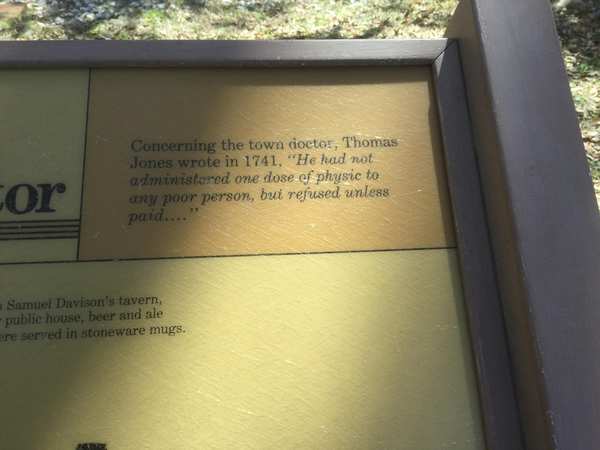
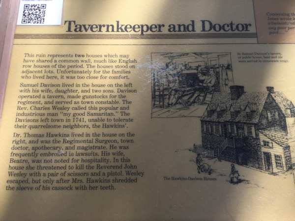
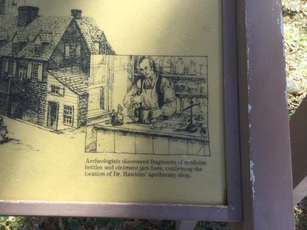
The administration flagged this panel because it states: “Dr. Thomas and his wife Beatre had a reputation for ill-temper and violence. The doctor often refused to pay for goods in town and Beatre beat their servants.” It also addresses visitors with: “Your house shared a wall with a meddling — and sometimes violent — neighbor.”
The administration flagged this panel because it uses the phrase “Black people” in: “Over the next century, millions of Black people left the South to find better jobs in more welcoming places.”
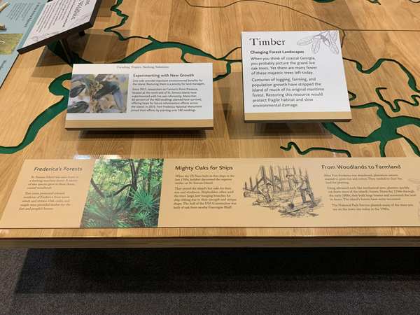
The administration flagged this panel because it states: “Centuries of logging, farming, and population growth have stripped the island of much of its original maritime forest. Restoring this resource would protect fragile habitat and slow environmental damage.”
The administration flagged this panel because it mentions “British merchants smuggling, British exclusive rights to sell enslaved Africans, Spanish guarda-costa stealing cargo/threatening/assaulting British.”
Photographs attached to this park's records in the leaked NPS review database.
Explore the Full Map
See all 446 entries across every national park and wildlife refuge.
Open Interactive Map →