Gateway National Recreation Area
Park History
Sourced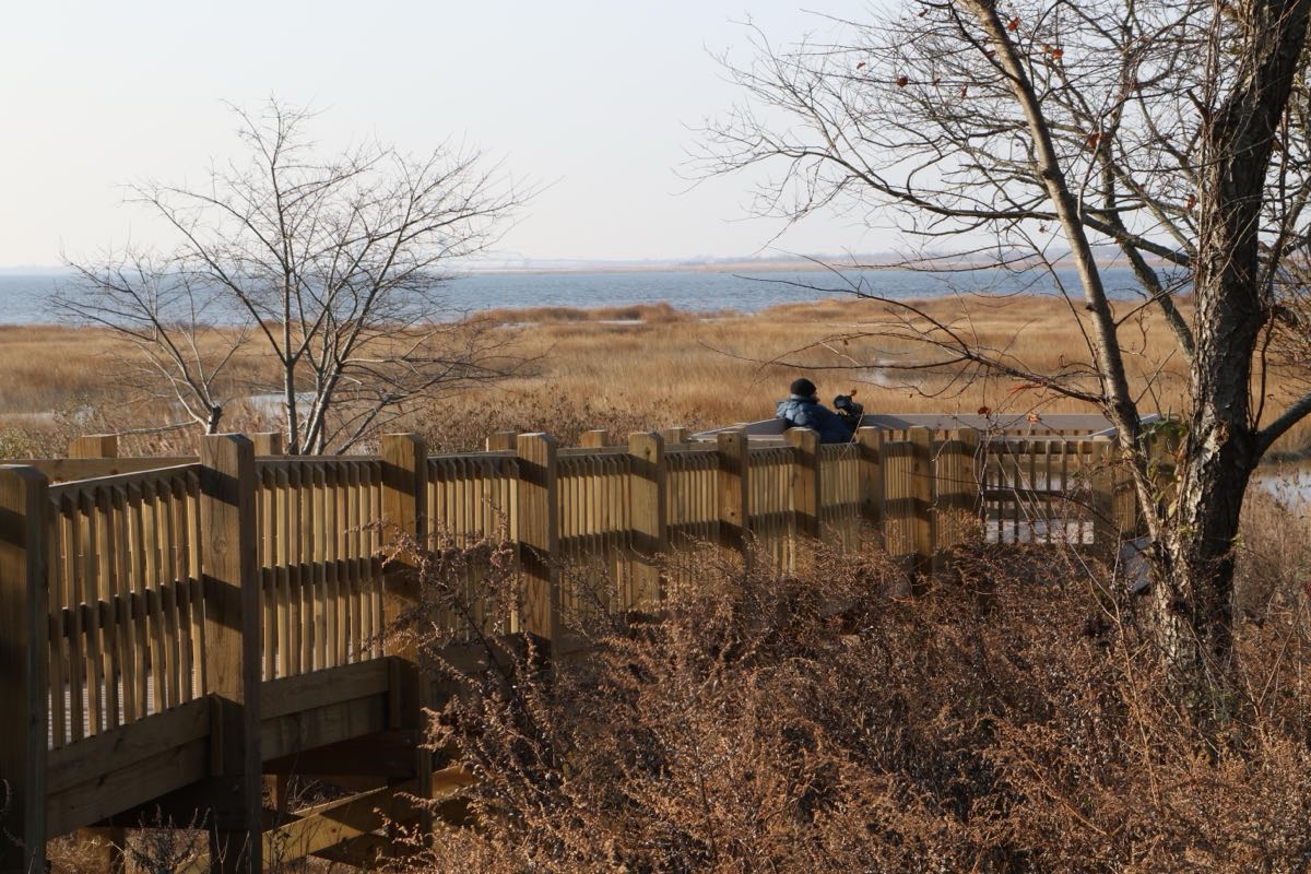
Gateway National Recreation Area wraps around the mouth of New York Harbor, an area known for more than a century as the “Gateway to America.” Its more than 26,000 acres reach from Sandy Hook in New Jersey along the south shore of Staten Island to Jamaica Bay and Breezy Point in New York — about 75 miles of shoreline, 31 of them ocean beach. Assembled from city parks, military posts and undeveloped land, it protects dunes, salt marsh islands and, at Sandy Hook, two globally imperiled kinds of barrier-island forest, maritime red-cedar woodland and maritime holly forest. More than 330 species of birds have been recorded here along the Atlantic Flyway. [1] [2]
The human story is as layered as the shoreline. The Sandy Hook Light, first lit in 1764, is the oldest continuously operating lighthouse in the nation; the Army opened its first weapons proving ground on the Hook in 1874; Fort Wadsworth guarded the Narrows for two centuries; and Floyd Bennett Field opened in 1931 as New York City’s first municipal airport, and during World War II the busiest military airport in the United States. [1] [2]
Congress established Gateway on October 27, 1972, as one of the first urban parks in the National Park System. Its foundation document counts more than 800 historic buildings, structures, landscapes and archeological sites, many already in poor condition when the park inherited them, and names the work ahead plainly: responding to climate change and sea level rise in a park most of whose natural and cultural resources lie beside the ocean and other water bodies. [1] [2]
Indigenous peoples
For thousands of years before the Dutch arrived, the northern shores of Jamaica Bay were home to the Canarsie, and the Rockaway peninsula to the Rechquaakie, “people of the sandy places” — both of the Lenape branch of the Algonquian peoples, according to the Park Service’s 2012 ethnographic overview. They gathered from the bay’s shellfish beds, leaving shoreline middens of oyster shell that the first European writers noticed, and, by early accounts, farmed a great cornfield that stretched for several miles across southeastern Brooklyn. From 1635, when Dutch settlers began building villages on land “purchased” from the Canarsie, warfare, disease and migration steadily weakened the Native communities; the authors date the death of the last known Canarsie person to 1830. Their legacy survives largely in place names: Rockaway, and perhaps Jamaica itself, which the report suggests may come from an old Algonquin word for “place of the beaver.” [3]
Black history
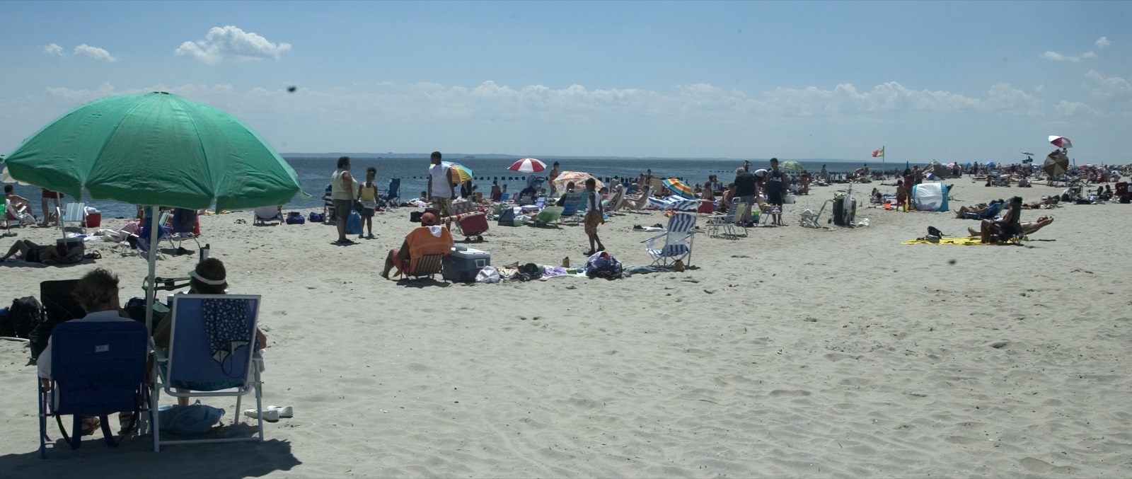
Riis Park’s beach was rebuilt by Robert Moses under a 1936 plan, and in 1974 more than three million people visited its mile and a half of sand. When City University sociologists Terry Williams and William Kornblum studied it for the Park Service (the 2000 assessment dates their report to 1975), they found it organized into territories: on summer weekends Bay 5 was the beach of Black and Latin visitors — West Indians, Cubans, Puerto Ricans — with drums, card games and parties into the night; on one July 4th, they numbered perhaps 30,000 across the park. The authors observed pointedly that the crowd hardly matched the middle-class white family the Park Service was comfortable serving, and urged caution before strict enforcement. A 2000 ethnographic assessment for the Park Service found Bays 5 and 6 no longer solely a Black American area but popular with a diverse group of Black Caribbean Americans, Black Americans and Hispanics, a change it tied to twenty-five years of new immigration to Brooklyn and Queens from all over the world. [4] [5]
Climate & environment
Most of Gateway’s natural and cultural resources sit beside the ocean and other water bodies, and its 2017 foundation document names responding to climate change and sea level rise as the first of the park’s key issues: the park has been changed by the frequency and intensity of recent storms such as Hurricane Sandy, some sites have already seen more flooding, and the park’s marshes and beaches serve as buffers that protect the neighborhoods behind them. When the document was written the park’s planning was still focused on recovering from Sandy. [2] A park climate poster on Jamaica Bay warns that its salt marsh islands, and the wildlife they shelter, are endangered by sea-level rise and human activity, showing Elders Point in 1951, when its restoration project started in 2006, and as restoration continued in 2010. [6]
Labor & the New Deal
The land under Floyd Bennett Field was once Barren Island, for much of the nineteenth century New York City’s offal depot and grease factory. A rendering and fish-oil industry began there in 1845; by 1884 about 500 people worked in its plants, and at its peak in the 1920s and early 1930s the island held close to 1,500 residents — African American, Irish, Italian and Polish families whose children picked over mountains of garbage while their parents worked the try works. The overview dates the eviction of the community to 1936, when Parks Commissioner Robert Moses had it razed for bridge approaches; one former resident, quoted in the overview, remembered only the western half being evicted and about 30 families staying on until 1939. Jane Shaw, for nineteen years the island school’s principal and only teacher, fought for time to let her pupils finish the school year and, in historian Benjamin Miller’s account, succeeded. The 2012 ethnographic overview suggests the eviction stands with the removal of Seneca Village for Central Park, as another example of the powerless being removed to create valuable public places. [3]
LGBTQ+ history
At the eastern end of the beach, Bays 1 and 2 were, in the 1975 study, the home of a large gay community whose use of the beach, Williams and Kornblum reported, already went back more than twenty years; on an average day Bay 1 was about 70 percent gay and Bay 2 about 90 percent. They quoted Arthur Evans, writing in the gay publication The Advocate, on Riis as a haven — one place gay people could be openly themselves. A quarter-century later, the 2000 ethnographic assessment found that Bay 1 had retained its identity as a gay beach. Visitors described it as a space of freedom and liberation, one of the few beaches where they felt safe; some suspected that its neglected bathrooms and missing lifeguard reflected discrimination against them because, as they put it, they were gay and predominantly Black and Latino. In 2025 the Park Service listed Bay 1 as closed to swimming and access because of hazardous erosion. [4] [5] [7]
Sources
- NPSHistory.com: Gateway National Recreation Area archive page — overview (NPS brochure) and establishment block
- Foundation Document, Gateway National Recreation Area, New Jersey–New York (NPS, 2017)
- Kornblum & Van Hooreweghe, The Changing Traditional Uses of Jamaica Bay, New York: Ethnographic Overview and Assessment (NPS Northeast Region Ethnography Program, 2012), ch. 2
- Terry Williams & William Kornblum, Segregation and Use at Riis Park (CUNY Cooperative Park Studies Unit, NPS Research Paper #5, c. 1975), pp. 4–13
- Low, Scheid, Taplin & Honey, Rapid Ethnographic Assessment Procedure for Jacob Riis Park (CUNY Public Space Research Group for NPS, August 30, 2000)
- NPS poster, Changes in Sea Level at Jamaica Bay (Gateway NRA, Climate Friendly Parks, undated)
- NPS, Gateway NRA: Jacob Riis Park (nps.gov, last updated May 30, 2025)
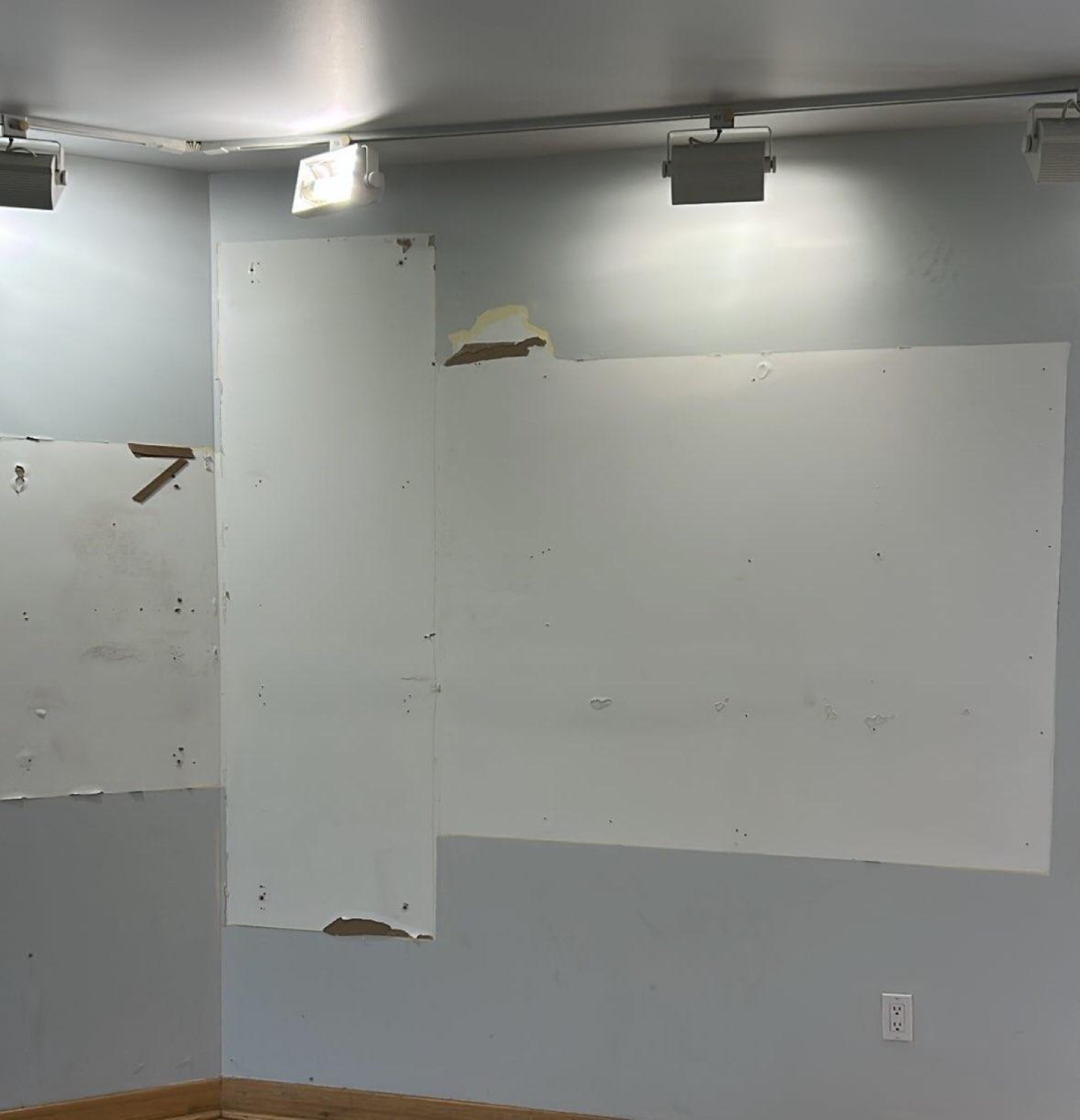
CONFIRMED REMOVED: Exhibit panels (2 items)
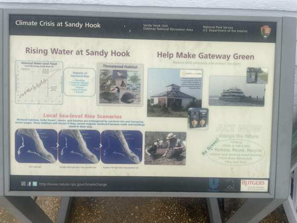
Gateway NRA in NY preserves a piece of American history that the public has trusted the National Park Service to protect and interpret. The exhibit panels at this site have been developed over years by historians, subject-matter experts, and park staff — and are now being reviewed under Secretary's Order 3431.
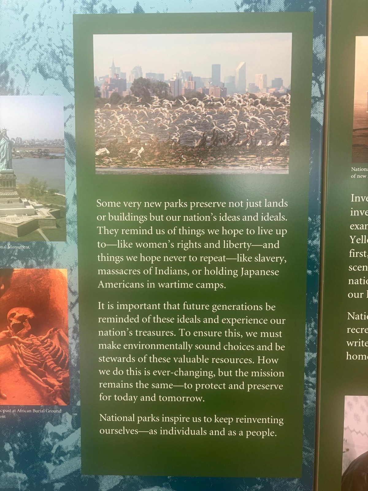
From the internal review records: “There are two exhibit panels in the Jamaica Bay Wildlife Refuge Visitor Center that may need to be reviewed. There is one digital exhibit in the Sandy Hook Visitor Center that may need to be reviewed. There is one wayside panel at the Jamaica Bay Wildlife Refuge and one wayside panel at Sandy Hook that may need to be reviewed. Photos of the exhibits and waysides have been attached, along with ...”
Why this matters: Gateway NRA is part of a network of over 400 national parks that serve as America's classrooms. The interpretive materials here were developed by subject-matter experts to help visitors understand the full story of this place. When historically accurate content is removed, the public loses access to its own history.
- “Jamaica Bay Wildlife Refuge Exhibition” — removed
- Jamaica Bay Wildlife Refuge VC exhibit; reason: Unrelated to beauty, abundance, and grandeur of the natural landscape; now: Discarded
There are two exhibit panels in the Jamaica Bay Wildlife Refuge Visitor Center that may need to be reviewed. There is one digital exhibit in the Sandy Hook Visitor Center that may need to be reviewed. There is one wayside panel at the Jamaica Bay Wildlife Refuge and one wayside panel at Sandy Hook that may need to be reviewed. Photos of the exhibits and waysides have been attached, along with transcription of the text in question.
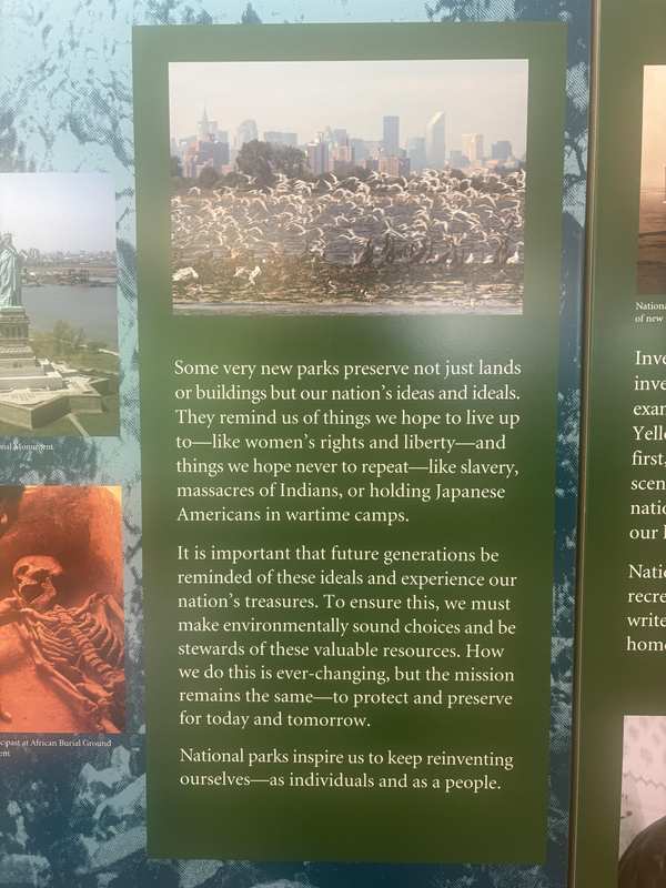
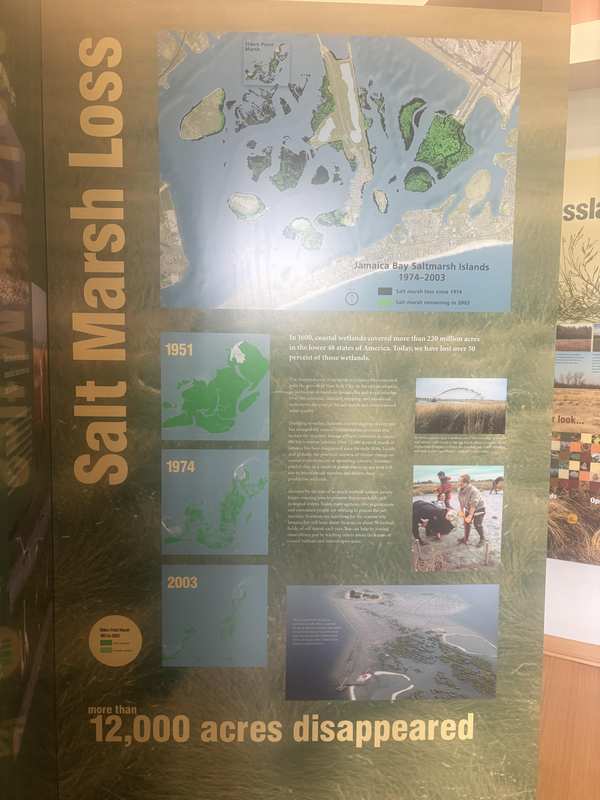
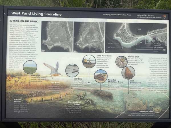
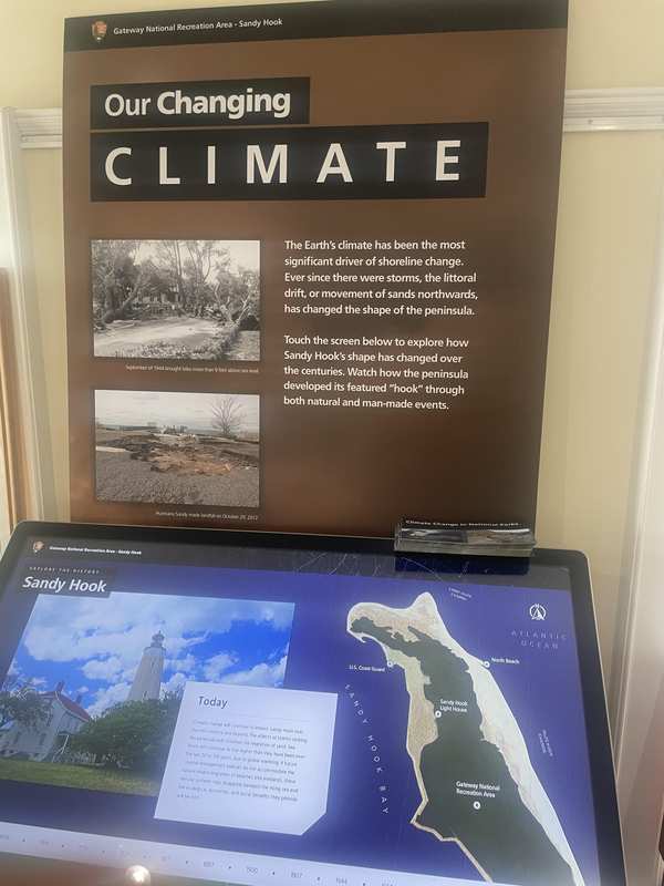
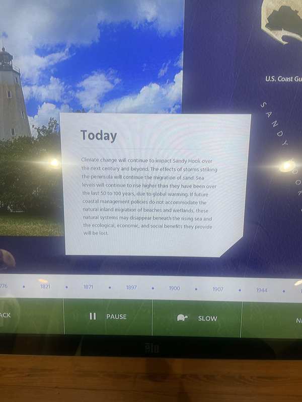
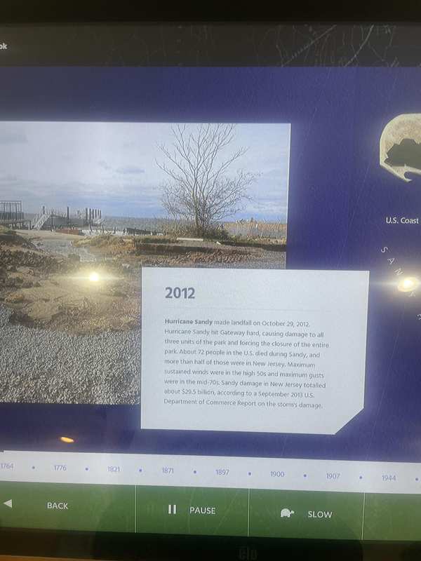
Photos courtesy Save Our Signs (public domain)
News Sources
VerifiedExplore the Full Map
See all 446 entries across every national park and wildlife refuge.
Open Interactive Map →