Guilford Courthouse National Military Park
Park History
Sourced
On the clear, cold morning of March 15, 1781, some 4,400 American troops waited in the damp woods west of Guilford Courthouse, the hub of an isolated farming community on the main road through North Carolina. Nathanael Greene had chosen the ground: a line of North Carolina militia behind a rail fence at the edge of cornfields, Virginia militia in the forest behind them, and his Continentals on an open hill before the courthouse. Charles, Earl Cornwallis’s regiments came into sight about 12:30, and after more than two hours of fighting, much of it in tangled woods, Greene withdrew. The British held the field, but their losses were overwhelming; within days Cornwallis was retreating toward Wilmington, and seven months later he surrendered at Yorktown. [1]
The park’s 2014 foundation document calls the battle one of the most intense engagements of the Revolutionary War, so costly to the British that Cornwallis changed his whole southern strategy. The county courthouse that gave the battle its name was built in 1775 near the Great Salisbury Wagon Road; George Washington visited in 1791, the county seat moved six miles south in 1808, and nothing remains of the building or of the town later named Martinville. The 2015 ethnographic overview reports sound archaeological evidence for the first and second battle lines, but the courthouse’s location remains hypothetical. [1] [2] [3]
Judge David Schenck and the Guilford Battle Ground Company began preserving the field in 1887, raising monuments and marking locations. Congress established the national military park on March 2, 1917 — the first Revolutionary War battlefield protected by the federal government, the foundation document notes. It protects about 250 of the roughly 1,000 acres of the battlefield, in what is now the northern part of Greensboro. [1] [2] [3]
Indigenous peoples
When the English first explored the North Carolina backcountry in the late 1600s, the Great Trading Path, or Occaneechi Path, was one of many Native American trails — not a single path but a braided network linking the many small villages of the Piedmont. That network laid the groundwork for colonial towns, and the road through the battlefield, now New Garden Road, probably grew from an existing trade path between Salisbury and Hillsborough, the park’s 2017 historic resource study finds. [4] The 2015 ethnographic overview notes that the most recent archaeological overview (Prentice, 2014) recommends more survey and excavation to determine Native American prehistoric occupation of the site, and that its researchers tried without success to interview Native Americans for the study. [3]
Women
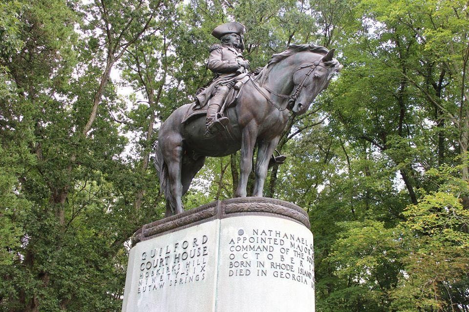
Of the park’s 28 monuments, the two to women honor Kerrenhappuch Norman Turner and Martha McFarland McGhee Bell. The Guilford Battle Ground Company raised Turner’s statue in 1902, its first to a woman; by oral tradition she rode on horseback to her badly wounded son after the battle and nursed him back to health, and the statue shows her holding a cup of water and a towel. Company president Joseph M. Morehead, her descendant, claimed it as the first monument to a Revolutionary heroine erected in the United States. Bell’s monument came in 1929, raised by a Daughters of the American Revolution chapter. [4] The 2015 ethnographic overview recounts that Bell, a widow, ran her late husband’s mill and trading business, and that Cornwallis occupied her farm and mill after the battle. Quaker women, it adds, tended the wounded of both armies. [3]
Black history
African Americans took part on both sides of the battle, and the park’s interpretive materials have discussed their role since the 1970s, the 2015 ethnographic overview reports — but no monument marks it. Of the park’s 28 monuments, 26 commemorate white men. The park film portrays two Black soldiers, one fighting for the British and one, Ned Griffin, for the Americans, though the overview notes recent documentary evidence that Griffin enlisted after the battle. Most of the nine African Americans interviewed for the study said the park does not do enough to profile African American contributions to the Revolution, which, they noted, promised equality but left slavery intact. [3]
Slavery
Small farms, not large plantations, dominated Guilford County, the 2015 ethnographic overview reports. In the 1790 census, 180 of its 1,188 households (15 percent) held people in bondage, against 55 percent in New Hanover County on the Lower Cape Fear; nearly 40 percent of Guilford’s slaveholding households enslaved one person, though some held nearly 30. David Caldwell, the Presbyterian preacher honored with a statue in the park, was listed as enslaving eight. [3]
Local Quakers often recount the boy Levi Coffin confronting the elderly Caldwell over his plan to send an enslaved woman away from her husband and children as a gift to his son; in the version a Quaker historian gave the 2015 ethnographic overview, the family hid in the New Garden woods, Coffin walked five miles to Caldwell’s farm, and Caldwell relented. Quakers interviewed for the study described Greensboro as the southernmost point of the Underground Railroad. [3]
Sources
- NPSHistory.com: Guilford Courthouse National Military Park archive page — overview (NPS brochure text, 2012) and establishment block
- Foundation Document, Guilford Courthouse National Military Park, North Carolina (NPS, 2014)
- Griffith et al., An Ethnographic Overview of the Guilford Courthouse National Military Park (East Carolina University for NPS, January 28, 2015)
- Historic Resource Study, Guilford Courthouse National Military Park (The Jaeger Company for NPS, 2017)
Removed Per Nps Court Filing: Exhibit panels (11 items)
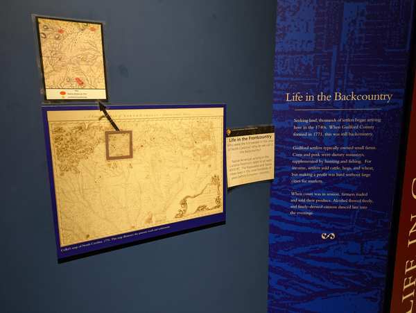
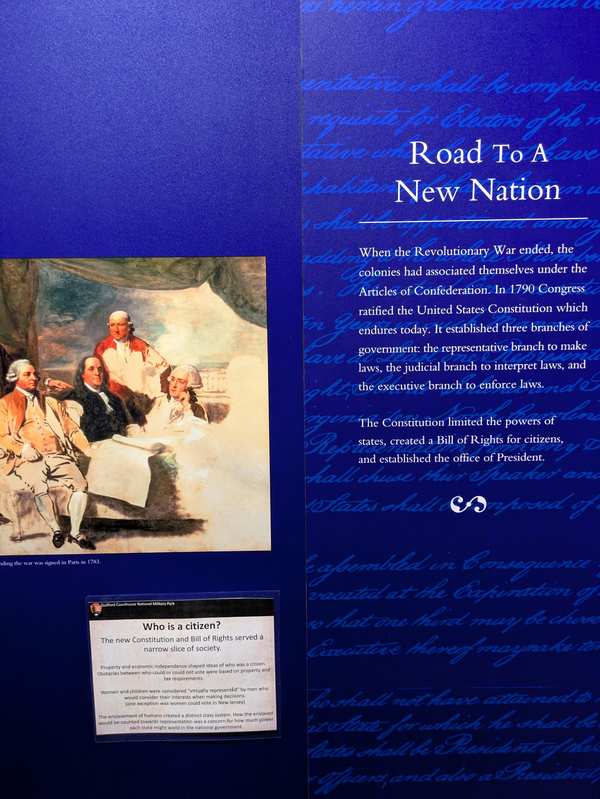
Guilford Courthouse NMP in NC preserves a piece of American history that the public has trusted the National Park Service to protect and interpret. The exhibit panels at this site have been developed over years by historians, subject-matter experts, and park staff — and are now being reviewed under Secretary's Order 3431.
The administration has ordered revised content that includes the language: “temporary exhibits”, “additional context”, “additional context”, and “additional context”.
Why this matters: The specific language being targeted at Guilford Courthouse NMP — including “temporary exhibits” — is historically accurate content developed by professional historians and park staff. When this language is revised or removed, visitors lose access to the documented record of what happened here.
- “Exhibit panels in Visitor Center” — removed per NPS court filing
- Exhibit panels in Visitor Center; reason: Disparages Americans past or living; now: At the park
The interpretive panels in the visitor center are nearly 25 years old. The panels and the desplayed museum objects have not been changed/edited or rotated since the 225th anniversary of the siging of the Declaration of Independance nearly 25 years ago.
To supplement the out of date experience, staff created “temporary exhibits” (laminated 8.5x11 sheets of paper) to provide visitor with some additional context for the out of date exhibits/panels. They created 5 “additional context” panels and one introductory panel that provides some context for the “additional context” panels. The introductory panel also encourages visitors to engage a ranger if they have questions about the “additional context” panels.
Generally, the public has been receptive to the temporary panels, so it would be our preference to leave them up. These are being submitted out of an abundance of caution. If they're determine to be in conflict with the EO/SO, we'd simply take them down. They're taped to the wall.
The link below will lead you to a shared one drive folder belonging to the supervisory park ranger. It contains images of the temporary panels and the permenant panels for context.
Explore the Full Map
See all 446 entries across every national park and wildlife refuge.
Open Interactive Map →