Ocmulgee Mounds National Historical Park
Park History
Sourced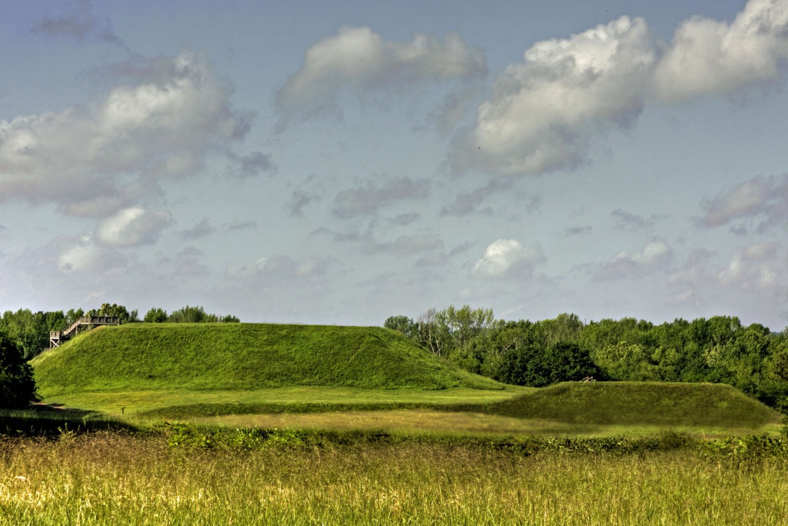
On the Macon Plateau above the Ocmulgee River in central Georgia, earthen mounds mark one of the longest records of human habitation at any single site in the national park system: more than 12,000 years, by the 2014 foundation document’s count, or 10,000 in the 2013 park brochure. Between about 900 and 1100, Mississippian farmers built a town of thatched houses on the bluff, raised earth mounds over the years as places important in their religion and politics, and made more than 100 burials in the Funeral Mound, some with elaborate shell and copper ornaments. The Great Temple Mound rises 55 feet. The reconstructed Earth Lodge, 42 feet across, keeps its original clay floor, about 1,000 years old, with a bird-shaped platform opposite the door. In the Lamar unit, Mound B climbs by a spiral ramp, the only one known in the country. [1] [2]
According to Muscogee (Creek) tradition, the Ocmulgee Old Fields are where their ancestors first sat down to farm the river terraces. English traders from Charleston built a trading post here about 1690, and many Creeks settled nearby. Local citizens bought land and gave it to the government; Congress authorized the national monument on June 14, 1934, and President Franklin D. Roosevelt established it on December 23, 1936. In 1999 the Old Fields became the first place in the eastern United States listed in the National Register as a traditional cultural property, and in 2019 the monument became Ocmulgee Mounds National Historical Park. [2] [1]
Indigenous peoples
The Muscogee (Creek) Nation claims Ocmulgee as ancestral ground, and so does the Seminole Nation, the 2021 historic resource study says; Creek people it interviewed described it as a place of origin. For Native people the arrival of Europeans was catastrophic, the 2013 brochure says, and disease caused staggering losses. In the 1805 Treaty of Washington the Creeks ceded much of Middle Georgia but kept a tract of about 15 square miles around the Old Fields; a treaty of January 8, 1821, took all Creek land between the Ocmulgee and Flint rivers, the reserve included. Under the 1830 Indian Removal Act federal authorities forced the remaining Creeks west; the 2014 ethnographic overview, citing Martin and McKane (2000), records 3,500 deaths on the Trail of Tears in 1836–37. In June 2012 the Muscogee (Creek) Nation marked it with a ride from Ocmulgee to Okmulgee, Oklahoma. [1] [4] [3]
Black history
The Dunlap plantation on what is now park land used enslaved labor. Plantation-era African American remains excavated there were mistaken for American Indians and displayed in the park museum until a visiting medical examiner corrected the error; one was a woman who had given birth, presumed enslaved, the 2014 ethnographic overview reports. In the 1930s the excavation crews were segregated: the 2021 historic resource study, quoting Alan Marsh, says the archeological laborers at Ocmulgee were white and most were male, largely because white managers feared a large crew of Black men. At the nearby Swift Creek site, from March 1936, archeologist A. R. Kelly’s WPA field crew was Black women, 30 to 40 by the count the study cites (about 40 in the ethnographic overview), kept off the main site, the study says, by Jim Crow laws and southern racial attitudes. The overview reports that site since destroyed, its bulldozed mounds a backstop for a sheriff’s firing range. [4] [3]
Labor & the New Deal
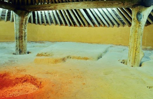
The Ocmulgee Old Fields became the site of the largest archeological excavation ever undertaken in the eastern United States, the 2014 foundation document says. The Ocmulgee Old Fields Project of 1933–1941 employed more than 800 workers, one of the largest workforces on any Works Progress Administration archeological investigation, and the work recovered roughly 2.5 million artifacts, established a standard ceramic and cultural typology for the region and led eventually to the Park Service’s Southeast Archeological Center. The Civilian Conservation Corps built roads, fences, plantings and park facilities; an all-white CCC crew arrived in 1937. The Earth Lodge was reconstructed inside a modern concrete shell over its original floor, and an Art Moderne visitor center begun in 1938 was finished only in 1951. [3] [2]
Sources
- NPSHistory.com: Ocmulgee Mounds National Historical Park archive page — overview (from the 2013 NPS brochure) and establishment block
- NPS, Foundation Document, Ocmulgee National Monument, Georgia (2014)
- NPS, Historic Resource Study: Ocmulgee Mounds National Historical Park (2021)
- NPS, Ethnographic Overview and Assessment of Ocmulgee National Monument (2014)
Removed Per Nps Court Filing: Publications (1 items)
Long before Ocmulgee Mounds NHP became a national park, this land was home to Indigenous peoples whose connection to it spans thousands of years. The interpretive materials now being reviewed tell their story — often developed through years of formal tribal consultation, as required by federal law.
From the internal review records: “This is a site bulliten available at the park visitor center. It discusses the harsh treatment of Native Americans during the Creek Removal period, and des ribes the policies and views of past presidents and other historical figures toward removal. This document directly relates to the park story and enabling legislation to preserve the Ocmulgee Old Fields, the ancestral homeland of the Muskogee P...”
Why this matters: The Indigenous history presented at Ocmulgee Mounds NHP was developed through formal tribal consultation — a legal requirement under federal law. The language being reviewed was often specifically requested by tribal nations whose ancestors lived on this land for thousands of years. Revising it without renewed consultation would violate both the spirit and the letter of that process.
- “Site bulletin” — removed per NPS court filing
- Site bulletin; reason: Disparages Americans past or living; not developed in consultation with Tribes; now: At the park
This is a site bulliten available at the park visitor center. It discusses the harsh treatment of Native Americans during the Creek Removal period, and des ribes the policies and views of past presidents and other historical figures toward removal. This document directly relates to the park story and enabling legislation to preserve the Ocmulgee Old Fields, the ancestral homeland of the Muskogee People. It is one of many publications that describe other aspects of the culture, archeology and history of this park and the people that are associated with it. This is the one publication that discusses the removal period, during which horrible acts were committed against the indigenous people of the Southeast. Publication is available via link.
Explore the Full Map
See all 446 entries across every national park and wildlife refuge.
Open Interactive Map →